Tales from Ladakh: The Chang La Queen
March 3rd, 2011
Check out our trip’s Grand Itinerary 😀
Unlike other places where you drive to reach a destination, in Ladakh, the journey itself is the destination. The road goes through such breathtaking vistas (and life-taking as well if you aren’t careful enough) that it is impossible not to be impressed by beauty of such magnitude. However, things aren’t rosy all the time. At high altitude, weather plays a crucial role in shaping up the day. This story is about one such drive when the weather was gloomy and we had very little time in our hands to afford the luxury of staying at Tangtse for an extra day.
When I woke up that morning, I felt fresh and the song Mazhai Thuli (rain drops) was playing in my mind. Almost instinctively I had a look outside the window and it was drizzling. I heard that Ladakh was a high altitude cold desert and that it doesn’t rain much. So I convinced myself that some clouds might be moving around and sprinkling some water on the way 🙂 . The usual blue of the sky was missing. The horizon had a few black clouds as well. Determined not to let go of the day, we got ready quickly. Ram P and Suresh started first on Ram’s Pulsar 220. Some time later, I followed.
I was well protected. Thermal inner wear, jeans, rain pant for the bottom and for the top, it was again thermal inner wear, followed by a t-shirt, fleece jacket and leather jacket. For the legs and feet, it was cotton socks, woolen socks and then ankle length leather boots. For fingers, I wore woolen gloves and Cramster’s leather gloves. As I started the ride, I was thinking that if it had rained a little here – at 14000 feet – would it snow at 15000 feet and above? That day we had to cross India’s third highest motorable pass known as the Chang La at 17000+ feet … in inclement weather. A light cold wind was blowing too!
The Drive
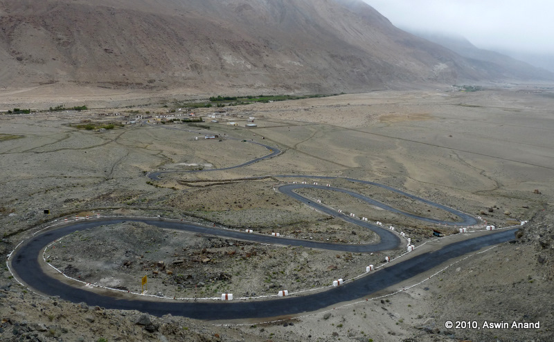
After 7 km I came to a fork in the road. Right fork led to Durbuk and the left fork led to Chang La and then to Leh. I took the left fork and few minutes later, the ghats started 🙂 . Drizzling stopped this time. But it was cloudy and the slight drizzle had wet the roads considerably. As soon as I crossed the first few hairpin bends, I saw the sight of a lifetime. The winding road with its various hairpins wound down to the plains at 14000 feet and then went to the fork in a straight stretch. Another fabulous straight stretch took the road to Tangtse. Both these towns were visible from this vantage point.
After clicking couple of pictures, I was on my way. Rest of the gang weren’t visible yet. Since I was on a 125cc bike, I wanted to start a bit early so that by the time my bike climbs, the heavier bikes can come quite fast and catch up. In most places, the roads were quite steep. The altitude was climbing steadily. I was well acclimatized and hence didn’t feel the pressure of oxygen. The drizzle came down harder and visibility was going down. Soon, I crossed the magical 15000 feet and crossed a heavily puffed up rushing river – over a fragile bridge 😀 . At many points, roads were joined vertically through off-road trails. Four wheel drive cars managed to climb up and down very easily while I was watching them from my 125cc!
Snow Attack
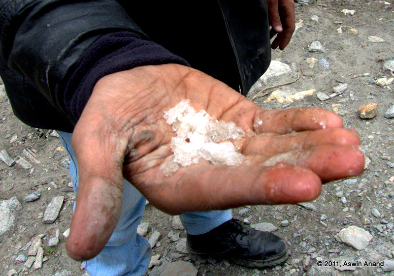
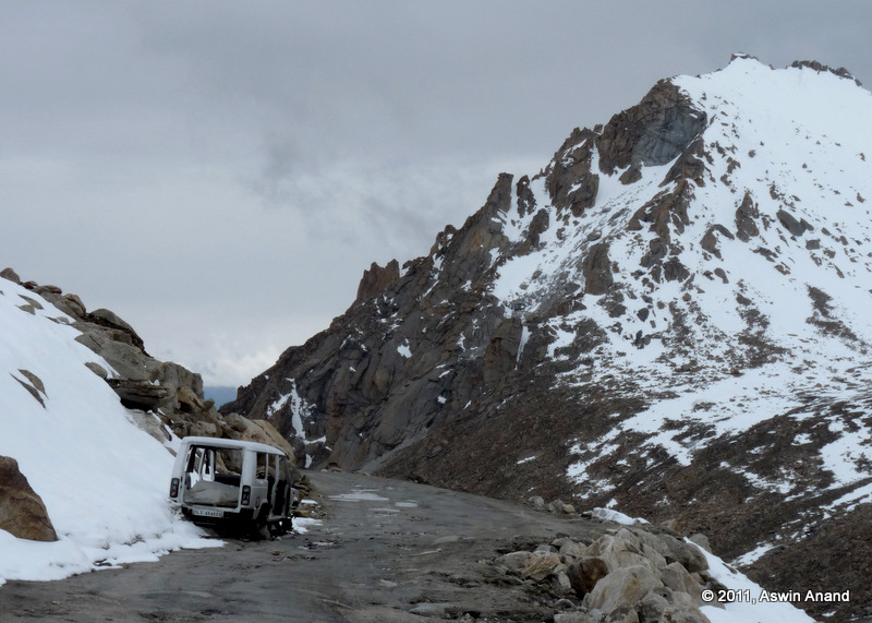
At about 15150 feet, I could feel the chill on my fingers. The warmth was long since gone and they were fast becoming cold. Feet were doing good so far. Suddenly, my jacket was no longer watery. A gray layer was forming as I was driving. I quickly realized what it was! It was snow! SNOW FALL. Snow was coming down real fast and it was being blown all around. Until then, when snow had come in contact with us, it would simply melt and wet the jacket. But that day was different. Snow fell on my jacket and it froze, becoming ice.
Within minutes, visibility was reduced to mere meters. Few minutes later, visibility was zero. Bike was wobbling slightly. I couldn’t see anything. Immediately I realized what had happened. Snow had fallen and frozen on my helmet visor, thereby taking out the visibility. I stopped the bike and took a minute to clean my visor. Snow was falling down hard and fast & it froze. It was not possible to drive with the visor on. Roads were steep and slippery. Hence, wearing the visor wasn’t an option. I started my bike again and took off. Soon, those tiny fluffy particles of snow started hitting my face and were pricking my eyes. Unlike rain, snow particles are really small, come in huge numbers & take a good helping of the skin! It was similar to a swarm attack.
My speed had come down to about 15 kmph. Through all this, I suddenly realized that bike stopped again. Reason? I couldn’t shift the gear. My little finger and ring finger were screaming in pain. They had frozen hard. I was at about 16500 feet now. Everywhere on the road, the milestones mentioned about the remaining distance to Chang La, Leh and the altitude. I was hoping there would be some place where I could have a cuppa chai 😀
Wish Granted
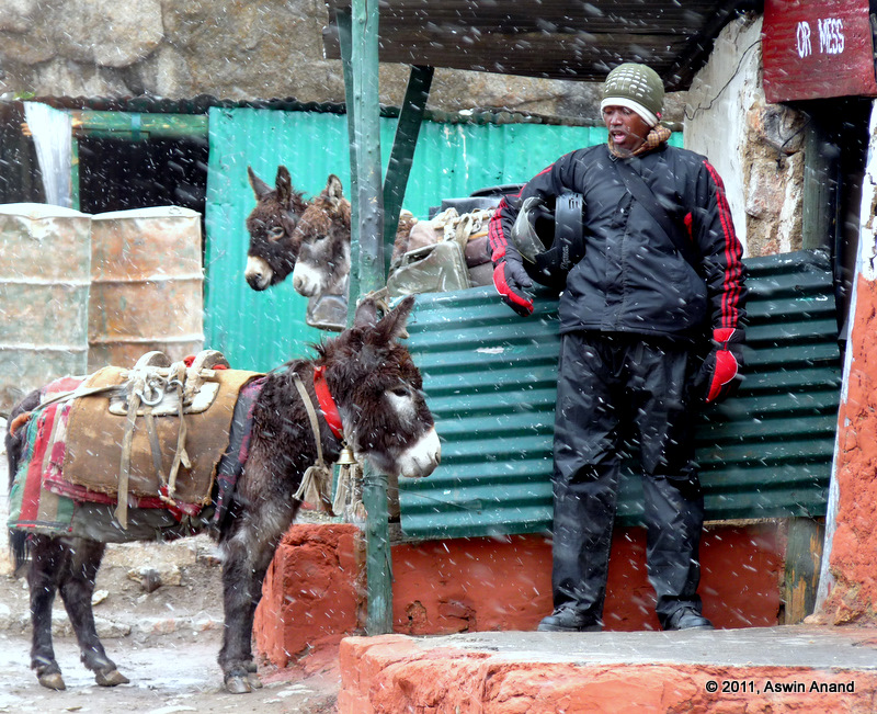
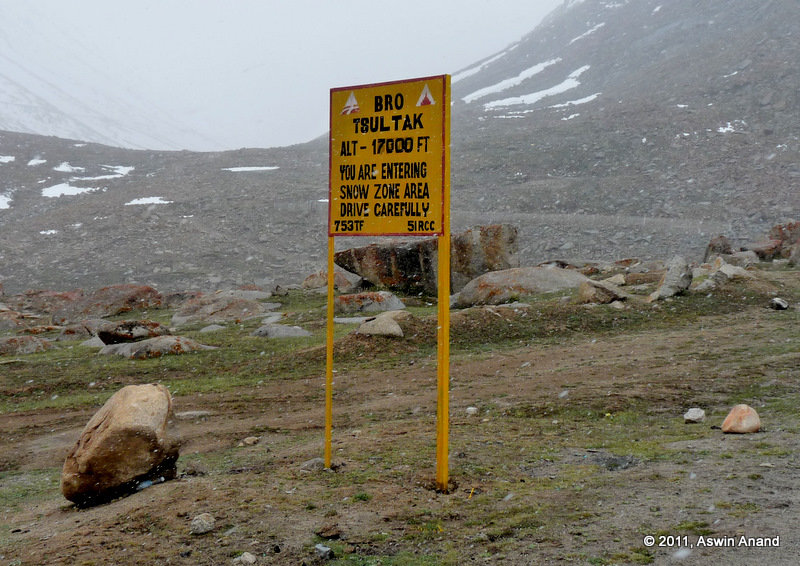
Ten minutes later, my wish was granted. I saw an army camp at Tsultak at 17000 feet. Along the direction board, there was another board which announced the facilities of the place & the one that caught my eye was the “Mess –>” direction board. I drove straight to the mess. My fingers and feet were pretty much frozen now. Any effort with them required enduring pain. Two army folks appeared from the mess.
Me: Mujhe thoda garam paani chahiye (I need some hot water)
Army dude: Pehle, helmet kholo (Remove your helmet first)
Me: (after fiddling with the helmet lock) – tried talking in Hindi (didn’t work out) – Please remove them yourself. Fingers are frozen.
Army dude: He smiled and then removed the helmet. I was called inside the small mess.
One guy was a Mallu and the other guy was a Tamilian. Seeing my TN registration plate, he asked in tamil, “Neenga yengendhu varinga (Where are you coming from?), for which I answered “Chennai.” I was damn happy to hear a guy talking in Tamil at 17000 feet. Apparently, they were from the Madras regiment and they had just returned from a posting on top of Siachen Glacier!
A huge cauldron of boiling water was in the middle of the mess. With almost no effort, he lifted the cauldron from the stove and moved it elsewhere. I was stunned at his strength. Then he increased the flame and got a chair for me. He also helped me remove my shoes. Both my socks were wet. Toe edges had become white. Fingers were frozen. As the flame increased, I thawed them, massaged them and brought them back to life. In an impulse, I put my bare feet on the ground and felt the chill sending a shiver up my spine. The army dude then inquired about the bike trip and said that winters in that place were truly horrible; with temperatures reaching -10 during day time itself. As we were discussing about his life and my trip, he asked how many people were we. I said 13 and then he asked whether we’ll like corn soup!
Corn Soup
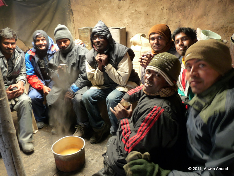
I pinched myself. What? Corn soup? At 17000 feet with snow wrecking havoc around? Before even I could reply, I thought “WOW! That’s dulcet” and then I said “Yes! We would love it.” By that time, the rest of the gang had come in and they were getting toasty in the visitor’s room. Soon, the soup was ready. Everybody took large helpings of the soup. As the hot soup went down my throat, I could feel life surging back in my limbs and body. Various parts of my body along the oesophagus started to absorb the warmth. As the warm soup splashed my stomach, it was nearly orgasmic. After warming up sufficiently, we headed to Chang La. It was few kilometers from the army camp.
The army guys warned us that we were about to enter avalanche zone and that not more than one bike should cross the zone at anytime. Since it was also snowing, the risk of avalanche was higher. We bade them goodbye, thanked heartily and then went on our way.
Chang La
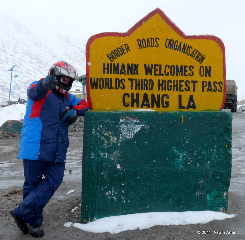
Seeing the prayer flags flap in the chill breeze was a HUGE relief. I felt happy from the inside for coming that far. I was thinking of how folks would feel when I narrated the story to them after getting back. My mind drifted to Chennai. Then, it was time to savour the moment. At Chang La, the Indian Army gives free tea to everyone who makes it there. After couple of group pictures and a funny dance (am trying to find the video), we bought some mementos and then started to Leh. We crossed snow fields and some more avalanche zones.
Weather was showing some improvement. Though chill winds were blowing, it was not snowing. Through winding roads and more splendid views, we reached the beautiful village of Sakti and then reached the outskirts of Leh by around 4 PM. Paari and Arul went to Hemis Monastery. Rest of the gang, caught on the football fever, found a ground to play. I went to Thiksey monastery and then drove to Leh. Due to an earlier adventure that’ll be described in the next post, I missed Leh Palace before. So I drove to Leh.
Sunset at Leh
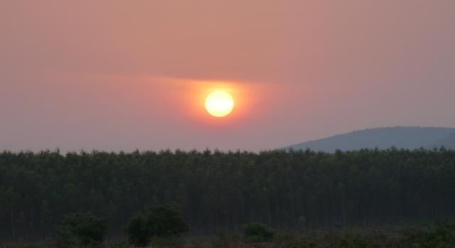
It was around 6.30 PM by the time I reached Leh. Sun was setting and I was offered a splendid view of the sunset from the top of the Leh palace. I made friends with the Buddhist monks there and they were telling their stories. I wanted to climb to Castle Tsemo opposite to the Leh palace. But unfortunately, it was becoming cold quickly and it had already become dark. So I thought Castle Tsemo was for next time and then went back to our home stay.
The day was absolutely brilliant and it was one that I would never forget in my life! Even months after coming back, that day is still fresh in my memory. I can recollect every detail even now. I can’t stop talking about the beauty of Ladakh.
See you soon on the next adventure post!
Buxfer – Automatic Data Backup
February 15th, 2011
A month ago, Buxfer.com went down & took down a month’s worth of data along with it. Thankfully I had a CSV export of my data before the website went down.
After that, I wrote a simple utility script that will automatically do a full CSV export of Buxfer accounts data and email it. At the start of the script, there are couple of PHP variables that you can use to customize it – your buxfer id and password, from email address, to email address, email content etc. To automate it completely, use crontab to schedule its execution and rest in peace 🙂 .
I have hosted the code at GitHub. Do check it out and let me know your feedback. Or better yet, fork it and add your bells and whistles.
The Goal for 2011: Integrity
January 22nd, 2011
This year, I have decided that I’ll live with integrity. I will be my word.
- If I say, I’ll be at a place by 8 AM, you can expect me there on time.
- If I say, I’ll get something done by a given date, you can be assured that it’ll be done in the best quality possible that I can fathom.
- This year, I will only do stuff that I’m passionate about. So, if I write apps, it is because I’m passionate about them. If I travel, it is again because I’m passionate about it.
- I’ll not cheat myself. If my conscience says I have slipped, I’ll see what went wrong and try to improve on that rather than going in to denial.
- Part of this integrity exercise is saying “No” to stuff that I don’t want to do.
What’s with this year? Why did I decide to do it this year?
The strongest motivator was this parting email by a Microsoft executive sent to his colleagues. The portion that intrigued me was this:
The foundation of who I am is based on living with integrity. Integrity requires principles, and my primary principle is to focus on doing the right thing, as best I can. The best thing, to the best of my ability, for our customers, our products, our shareholders, and of course, our people.
Other principles, or guideposts by which I live, are learning from and listening to others to make the best decision possible; not being afraid to admit a mistake and change a decision when it is wrong; being consistently honest, even when it hurts; treating our customers, partners, and people with the respect they deserve, with the expectation that each of my actions forms the basis of a lifetime relationship; and finally, being willing to admit and apologize when I have not lived up to these principles.
Integrity is my cornerstone for leading people. Leading starts by setting a strategy – not one that I’ve dreamed up myself but something that my team has worked together to create. The strategy provides the North Star for each person.
I suddenly realized that to achieve bigger goals in life, the smaller ones need to be tackled. Without integrity, it is simply impossible to focus on them. Integrity gives you a solid foundation on which you can stand, command goals to fall in line and act on them one by one. It is that magic wand which will make rabbits appear out of seemingly bottomless hats.
30 Day Trial
Since this is going to be a big change to my life, I will start with a simple 30-day trial to see how this works. The trial ends on 21-Feb-2011. I’m totally excited about the changes it will bring in my life. Throughout the 30 days, I will collect data on various tasks. For e.g., “Have I been on time for meetings? If there are ‘x’ meetings this month, how many have I been to on time? Am I well-prepared for every meeting? Have I met milestones?” etc. The questions will obviously vary depending on the task at hand. But the point is to collect data so that I can look back at them at the end of 30 days and see how I have fared.
For starters, I have collected some data on my morning wake up time. Over the last 50 days, I’ve gotten up at/before 6.30 AM only 7 times. The data speaks by itself. No questions asked. So, by the end of 30 days I’ll know. I’m publishing this on my blog so that I don’t chicken out in the middle.
Wish me luck.
The Colours of Rajasthan: The Itinerary
January 9th, 2011
Rajasthan is a diverse and beautiful place that beats superlatives. Everywhere you go in Rajasthan, you will see so much colour and liveliness that you can’t believe that this part of the Indian sub-continent has so much happening. During much of this road trip in Rajasthan, we visited lesser known places and came back with an enviable experience. Combine this travel with an icing-on-the-cake type easy desert trek and you would never want to miss this 😉 .
I did miss some regular tourist spots though (like Mount Abu, Ajmer, Pushkar etc.) but I guess I’ll cover them at leisure when there are no better places to visit. Except in the months of May and June – when summer is at its peak – rest of the year is open for tourists. November, December and January are particularly very cold. The desert trek was organized by Youth Hostels Association of India. Without much ado, here’s the itinerary of the trip.
Tales from Ladakh: The Grand Itinerary
July 28th, 2010
Ladakh – Below is a snippet of the lyrics from the song “Kanmani Anbodu” from the movie Guna.
Unnai enni parkayil kavidhai kottudhu
Adhai ezudha ninaikayil varthai muttudhu
la la la … la la la …
It roughly translates to, “When I think about you, emotions flow; but when I try to put them down, words fail me.” That exactly describes how I feel about Ladakh and the bike trip. The beauty of Ladakh beats all superlatives. Its memories left me in a dreamy state for days together … making sure that I longed to visit that place again and again.
I totally felt at home at Ladakh. The people were cheerful and friendly. The weather was so cold that its summer was like Chennai’s winter. Mile after mile, we passed through breathtaking vistas, rushing rivers, snow capped mountains, snow storms, bad roads, snow fields and what not! Each of those scenes screamed at us to stop, close our eyes, take a deep breath and take in that scene. Much of those even rendered me speechless. Sunset time was especially brilliant. Though we were never able to see the actual sun set – because of high mountains around – the golden light created so much contrast that everything around us opened up to its purest beauty.
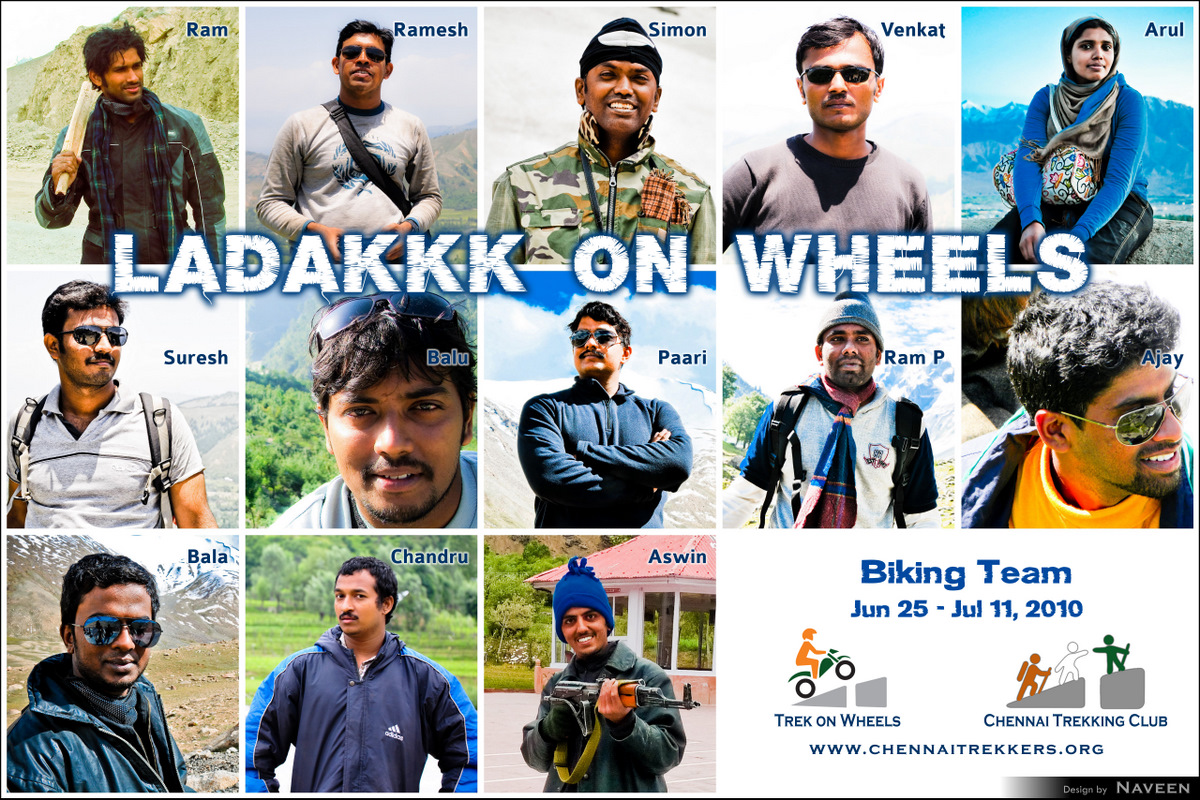
There were 13 of us on the Grand Ladakh Trip and I’m sure every one of us had personal special moments that we will cherish for our lifetime.
If you like this post and my other travel adventures, do subscribe to my RSS feed. I’m sure you will love it!
[sniplet LadakhItinerary]
Summer, Water, Survival and Rescue
May 12th, 2010
Well… it was a terrific Sunday. I’m not going to tell you the regular story of how beautiful the hills and streams were and how we jumped and monkey dived from top etc. Instead, I’m going to tell you the story of how mental clarity and strength of will helped resolve a critical problem.
By the way, If you like this and other trekking stories of mine, I would strongly suggest that you subscribe to my RSS feed. You won’t regret that decision I tell you.
The Setting
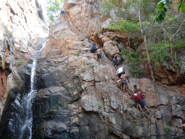
On Sunday morning, the last water point was at around 10.30 AM. I drank about a litre of water, got some water on my backpack and we started moving ahead. We proceeded to hit a side-stream which would (according to the maps) take us somewhere close to the exotic Nagalapuram’s regular first pool. By about five hours after we started walking, all water resources had been exhausted & most of us were thirsty. We hit upon a 15m fall in the stream and couldn’t proceed any further. Straight and butter smooth rocks rose on both sides which made direct climbing impossible.
The 15m fall didn’t have any place to hold and climb down. But there was water there & we couldn’t even reach it with ropes. Eventually we decided to climb around it and then go down. The direct route was very bushy and thorns started raping us in all places where even a tiny bit of skin was visible. So, we backtracked some distance and climbed an 80 degree incline. Best thing about the incline was that, it had a good number of crevices to keep our hands and legs for balance. By the time we started climbing that incline, it was 3.30 PM. The sun was mercilessly burning down on us and the rocks were hot.
The Climb Up
Many of us were able to do the climb. Some did it slowly, some did it quickly, some did part of it quickly and part of it slowly & some of them had to be helped. But climb up … we all did. It was around this time that dehydration started to hit me. Every cell in my limbs were screaming for water. Blood receded from my finger tips and created wrinkles. Then I stopped climbing and noticed that a good number of people were still way down. That would give some time for rest. I wrapped my arms around a tree to stabilize myself and slept standing for sometime… may be 5 minutes. But that didn’t work out. So I removed my backpack, found a flat rock and rolled over there to get an amazing sleep for the next 1 hour 15 minutes. The sun was burning down and there was not much shade. But with a towel to cover my eyes and arms, sleep couldn’t have come at a better time.
During regular climbing, if I had said that piece of rock as “flat rock”, I would have been called a dumb ass 🙂 but who cares when you want some rest?
Eventually everyone made the climb. It was around 6 PM now. The sun began to lose its intensity and a cool breeze was drifting around. That pushed me in to another 15 minute siesta. The gang stabilized and was gearing to climb down. After the climb down, we would get to that elusive elixir of life. This guy, let’s call him Jay, was the last one to climb up. Myself and Anand took the responsibility of getting him to the base camp. We were told to give him some rest and then take him to the hill’s peak and walk along the peak until the gradual descent began. That way, there wouldn’t be much pressure and since we would go on to the peak, the breeze would be good too.
The Sunset
After few minutes of rest, myself and Anand pushed Jay to start walking. It was getting dark and being stuck on the mountains during darkness isn’t a fun thing. We pushed, pushed and pushed, with myself and Anand taking turns to carry couple of extra backpacks. After 30 minutes of walk, we rested. The sun was setting just behind us on a mountain. The sight was breathtaking and so wonderful. But Jay’s spirit went down with the sun. The sun going down meant that twilight would be available only for about 30-45 minutes more and that was too less a time to get down fast.
We pushed off again and didn’t give rest for Jay for the next 45 minutes. It was pitch dark by then. But we knew where we were because right down the hill, we saw the dam and people could notice our torches too. That way, we were safe and didn’t actually get lost. By around 8 PM, Jay lost all gas and plopped. He couldn’t move much without water and was mumbling something. Anand was beginning to get low because of the current situation. We yelled for a few people from the top of the hill but no response came. Every time we thought we heard a response, it was the wind playing games. Jay’s situation was getting bad.
Stars appeared here and there and in a few minutes, a whole orchestra was being played in the skies.
The Idea
I suggested that instead of waiting for help, it would make sense to walk for 10 minutes and rest for 20 minutes. That way, we would at least reach the bottom of the hill and be near water. We could drink water to our heart’s content and even camp there for the night. But that was not to be. As with Jay, Anand also announced that he cannot move anymore. Some coaxing and bullying didn’t work & that followed by more yelling for Peter, Biju, Alex etc. But no one heard us. Idea didn’t work out. Myself, Anand and Jay took turns showing our torch in case someone noticed. Sooner or later, they would have to figure out that we were missing.
Anand then called B in the city who told us he would get back to us immediately. I then talked to B, D and P and explained the whole story so far 🙂 and asked them to come from the city with some water because none of the trekking members were reachable. Then few minutes later Ansar called in and said he would come. I pinched myself literally and asked him to repeat it once more. He said he’ll pick up Sujai and come there for the rescue. Immediately Guru (the ultimate trekking and navigating machine) came to my mind and I told Ansar to pick up Guru also. Guru is a lean and a classic trekker full of stamina and power. While on call, Ansar also spoke to Jay and Jay’s spirit soared to some extent. He went from 🙁 to 😐 … In the time that followed, Anand snored peacefully while Jay and myself were talking some random fun stuff. I was happy that I was able to maintain my cool from a tense situation.
Peter to the rescue
Suddenly, Ramesh (one of the trekking members) gave a call to Anand’s number asking where we were. I shone the torch from the top of the hill. He could see us but I couldn’t see him. He said Peter was looking for us and coming in the direction of the torch with some water. I felt “WOW”. In an hour or so, Peter reached us. Jay’s spirit went from 😐 to 🙂 . He gulped down some water with electrol and his face lit up almost immediately. I drank some plain water and waited for Ansar, Guru and Sujai to make their appearance. Peter had come in through some really dense bushes and didn’t want to go down the same way. Time was 1.30 AM. I couldn’t sleep anymore. The thought of going to the base camp and it being so near was exciting me to the core.
Help Arrives
In an hour (2.30 AM), we saw a bright orange light sweeping the ground beneath the hill. It was Ansar’s car. We gave a call to them. Guru woke up some locals near the dam and inquired about the easiest route to reach the torches on top of the hill. With the help of two locals, Guru and Sujai carried 6 litres of water and came to the top. Meanwhile, we packed our bags again and started walking downhill with Peter holding Jay’s hands and dragging him down. We climbed down for around one and half hours. A huge bear hug to Peter, Guru, Ansar and Sujai for coming there on time and giving us water. That was very timely and very quick response. It’s something that I will never forget in my lifetime.
4 AM
The sky was opening up to the sun slowly. It displayed a brilliant ochre that mesmerized me completely. Soon, I witnessed an awesome sun rise on the eastern hills and my spirits were back to normal. It was totally surprising that I could hold on in such a pressure situation & since I was able to handle that, I would be able to do better in other life situations I guess 😉
Any questions?
See you soon!
Social Trek to Nagalapuram
May 7th, 2010
Note: Click on the pictures for bigger versions.
If you want to see the craziest people in Chennai, it has to be at CTC. We trek on untamed terrain with awesome gangs in search of that elusive elixir of life. Once in a while, this craziness increases up a notch. What was once thought to be impossible or out of habit became a habit 🙂 … and one such habit was taking out underprivileged kids from many of the homes in and around Chennai for an easy trek in to the pristine jungles so that they can have fun as much as we do all the time.
That Sunday was special. Thanks to Thilak, the kids from SIP Home in Kolathur were taken on a beautiful one day trek to Nagalapuram’s Eastern side. I had taken a break from trekking for whole of April for swimming & when this trek invite came in, I was more than glad to accept it. What made that home special was that it cared for kids who are HIV+. What really surprised me was that the home was being run by a trans-gender. She was very supportive of us taking the kids in to the jungles for a day of bliss & she even accompanied us. At 61 years of age, she is supremely fit… fitter than any of the modern couch potatoes!
Cameras must be WiFi enabled
April 30th, 2010
Few months ago, I purchased a Panasonic Lumix DMC FZ-28 digital camera. It’s a bridge camera and has plenty of features. I’m totally in love with the camera. However, cameras such as this, Canon Powershot SX 20 IS etc. should have a few more features along with wifi enabled so that we amateurs are able to do a lot more easily 🙂
Here’s a typical work flow for my trek photos:
Go on a trek –> Click nice pictures –> Transfer the photos to the computer –> Make minor modifications such as contrast, brightness, saturation, cropping etc. –> Remove duplicates –> Add signature, copyright notice –> Generate a low resolution version of the final photographs –> Upload them to Flickr/Picasa/Facebook to share them with the world.
With these powerful cameras, much of this can be done on the camera itself. For e.g. my camera already allows adding signatures to pictures through a text stamp feature. It also allows notes to be added to pictures. The pictures can be cropped and frame freezes can be obtained from HD videos shot with this camera. While cropping, a tiny popup containing contrast, saturation and brightness could be displayed. Pictures can be marked with a star so that they can be cycled through while viewing the clicks.
What I want now
Each camera should have a nice file system API, network API and GUI API. Using these APIs, third party applications would be able to fetch photos from the memory card and do the required modifications. More detailed descriptions would be added to the photos and they would be preserved as part of the picture’s EXIF data.
The memory card should be formatted in a special way so that it can hold third party applications in a separate shell. This shell would be accessible through an iTunes like desktop software from which third party applications for the camera can be installed or removed. Once an application is installed, it should be displayed in an Application settings screen on the camera, from where the application can be activated or deactivated.
Once the necessary modifications are done, using the network APIs and WiFi, the application should upload the “starred” photos to flickr, picasa, facebook or any other service the application supports. All these and other services support HTTP APIs. Instead of the camera themselves supporting various services, it could just provide nice APIs and let the developers do the magic. While uploading each picture, a very high resolution picture should be scaled down for the web dynamically.
Geo Tagging
Oh wait! I want to geo-tag the photos as well. So, while clicking each photo, they should be geo-tagged in the background so that the actual speed of clicking a photo isn’t affected. Manually geo-tagging photos are a huge pain in the wrong places.
So, there you go! Click pictures –> Geo tag them in background –> crop them & make other minor modifications –> add text stamp for copyright notice –> Generate low resolution versions dynamically (cache them if required) and upload them!
Since most of the work is done by software in digital cameras, I think the stuff mentioned above is very much feasible. At least geo-tagging should be brought in as a feature.
The Facebook Funnel called the ‘Like’ button
April 26th, 2010
Note: I haven’t yet published some trekking posts since Feb. But this couldn’t wait. So they’ll be up soon.
By now, everyone must have been aware of the recent Facebook announcement of the universal Like button. As probably talked about all over the web, this one button is like giving too much of power to one company. By now the Like button should have appeared on thousands of websites already. Famous press blogs running wordpress should have had the Like button along their standard ‘share this’ toolbar. Facebook’s 400 million+ user base is a huge audience to showcase your content to & everyone wants a piece of the pie!
However, this like button reopens an old problem in a new way… User Privacy. Few years ago, when doubleclick.net installed tracking cookies for sending customized advertisements, it created a huge uproar. Similar stuff happened when Google History came about. But now, Facebook uses a clever way to track users that, you cannot even opt out if you don’t like the process. It makes of full use of the way how the web and ultimately, HTTP(S) works.
I’m not even talking about the case where you are logged in to Facebook and click on a ‘Like’ button on a website. That’s voluntary. You like a piece of content and you spread it to your friends and fans on Facebook. I’m talking about the case where you just visit a certain website containing the Like button and that data will be harvested by Facebook.
Like this on Facebook to understand how it works: [sniplet fblike]
How it works
Let us take it step by step:
- Clear cookies on your browser. If you are using Firefox or Chrome, press Ctrl+Shift+Del.
- Visit www.facebook.com
- Login to Facebook.
- Visit other websites to be tracked. So simple isn’t it?
When you first visit Facebook.com, it sets a cookie called “datr”, whose expiry is two years from now. So, if you visit Facebook.com today and never clear your browser’s cookies, you will be tracked for the first two years with “datr”. When that period expires, it will be replaced with a new cookie 🙂 and you will continue to be tracked. After you login to Facebook, it sets some more cookies on your browser along with a cookie called “xs” which is the session cookie for your Facebook session. If you remove this cookie, you will be redirected to Facebook’s login page. After login, “datr” and “xs” cookies will be refreshed.

When you embed the Like button on your website, it loads in an iframe in the Facebook.com domain. When a request is sent to any website by clicking on a link or by typing it on the browser’s address bar, the browser sends all the active (non-expired) cookies to the domain. So, when the Like button loads on a website, it makes a request to http://www.facebook.com/plugins/like.php. Along with this request, it will send the “datr” and “xs” cookies. It will also set the HTTP ‘Referer’ header to the originating website. For example, if you click on a Facebook.com link from my website, the Referer header will be set as ‘www.aswinanand.com’. This is used by other websites to determine where the user is coming from.
Now, when the ‘Like’ button loads on a website inside Facebook’s iframe, the Referer header will be set to your website’s page, “datr” cookie will be sent and if you have already logged in to Facebook, “xs” cookie will also be sent. So, just by loading Facebook’s Like button, Facebook will know what websites you had visited. Since the expiry for “datr” is set to two years, it will associate your Facebook logins to this cookie… which means, even if you logout of Facebook, it will know who the user is. Moreover, when you are logged in and move from one place to another, Facebook will know during what times of the day you are active and during what times you are inactive. When you are active, it will know from where your web browsing occurs and by being able to find location from IP address, they will know where exactly you are moving. Don’t worry, all this data will also be combined with your Facebook mobile usage and a final stat will be arrived at! That’s scary because it could reveal so much about a user & all privacy is gone with the wind.
Targeted Advertisements
This kind of tracking is something the user cannot opt out because sending cookies and setting HTTP Referer headers are part of the protocol. That means, you are tracked by default. Without your knowledge, your online behaviour and all the websites you visit (assuming they have added the Like button) after logging into Facebook are tracked by Facebook. This is useful for a lot of cases. Say you visit IMDB after logging in to Facebook. Each of the movie pages will have the like button. So Facebook will know which movies you are visiting. When you click on the ‘Like’ button for a certain movie, it gets to know your tastes and offer more movies along similar lines when you visit IMDB next. This same technique could also be used by spammers to trick you in to ‘liking’ some random link of their choice.
Like this, through the iframe based ‘Like’ button, Facebook funnels all required data to create a customized and scary experience.
Why not Google?
Ideally speaking, this was something that Google should have done a year or two ago. Most people I know are logged in to Google all their day and web browsing happens simultaneously. Just think of what would would happen if Google had done this. With their already powerful search tracking user behaviour and statistics, adsense would use this data to send specific advertisements to users. Google analytics is already deployed on tons and tons of websites all over the web. This one ‘GLike’ button could also be used to track statistics so easily. Now all of that happens on Facebook. Facebook is luring developers and users alike with its huge user base 🙂 . Combining a utility like ‘Like’ button with Google’s powerful anti-spam, anti-phishing and other anti-* mechanisms, it would indeed become a formidable force on the web.
What if you don’t want to be tracked?
If you don’t want to be tracked without your explicit approval, I would suggest browsing Facebook in Incognito browsing mode in Chrome, multiple profiles in Firefox or InPrivate browsing mode in Internet Explorer. All these modes will clear cookies and other history data when you close the browser window. So you might not be tracked as efficiently as possible.
I hope Facebook addresses this privacy concern. Facebook, please don’t be evil 🙂 with our data. I wouldn’t be surprised if Facebook launches a general purpose search engine in the next couple of years!
The Snake Walk
February 12th, 2010
Last Sunday was one of the best Sundays of my life. Through the Chennai Trekking Club with Pramod, Hopeland and our Irula Guide, we walked through farm lands near the Crocodile Park in the hope of finding our crawling friends. Little did we know that it would be an experience of a lifetime … From handling a Rat Snake to hearing a Spectacled Cobra hissing and striking, to a Russell’s Viper showing his deadly fangs and precious drops of venom; everyone was hooked, fascinated and intrigued by these mysterious yet beautiful creatures.
Btw, if you had liked this post so far and my other travel/trekking escapades such as Ombattu Gudde or The Kodaikanal Trek, you might want to subscribe to my RSS feed to get new posts as and when I write them.
